Florida’s Falling Iguanas Amid Record Cold Snap
Residents across Florida are receiving an unusual advisory this week: be vigilant for iguanas potentially falling from trees. This peculiar warning comes as a significant blast of wintry weather, one of the season’s earliest, sweeps across the eastern two-thirds of the United States, stretching from the Great Lakes region down to Florida and parts of Texas.
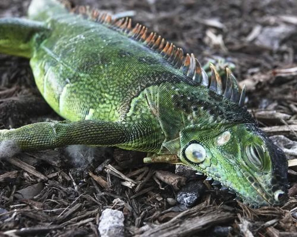
The reptile phenomenon is a direct consequence of plummeting temperatures. Green iguanas, an invasive species in Florida, become sluggish when temperatures dip below 50 degrees Fahrenheit and can enter a state of paralysis, effectively shutting down, if the mercury falls below 40 degrees. When this happens, they lose their grip and can tumble from their perches in trees. While often stunned, they are not necessarily dead and can revive once temperatures rise. The northern third of Florida, extending as far south as Gainesville, is forecast to experience freezing conditions.
Weather experts in the Sunshine State are urging the public to take the threat of falling iguanas seriously. Though rare, incidents can occur. A notable example from January 2023 saw a man participating in an outdoor yoga session in Miami struck and injured by an iguana that had fallen from a tree.
Winter’s Early Grip on the Eastern US
Beyond Florida’s unique challenge, the broader cold snap is delivering a powerful punch across a vast swathe of the nation. Heavy snowfall is anticipated in northern states, with particular intensity expected this evening in areas surrounding Lake Michigan. A winter storm warning, activated on Monday, alerted residents to potential wind gusts reaching up to 30 miles per hour, combined with as much as 18 inches of precipitation. These conditions are conducive to the formation of “thundersnow,” a rare meteorological event where lightning and thunder accompany a snowstorm.
By Monday morning, some parts of the Midwest had already recorded more than a foot of snow, signaling the severity of this early-season event.
Arctic Air Unleashes Record Chill
Meteorologists indicate that while this frigid period will be brief, it is poised to set new records for early November. The extreme cold originates from an Arctic air mass pushing down from Canada, extending much farther south and east than typically observed at this time of year.
Chad Merrill, a senior meteorologist with AccuWeather, elaborated on the unusual nature of the event. “This storm pattern will introduce some of the coldest air seen for early November and that is the reason for the robust snow amounts expected in the Great Lakes and the far southern extent of the flurries into the southern Appalachians,” Merrill stated on AccuWeather’s website. He further explained the mechanics of lake-effect snow, which is expected to be particularly intense: “The lake-effect snow bands that set up can dump several inches of snow in a short period of time due to the vast temperature difference betw…”
This widespread cold front underscores the dynamic nature of early winter weather, bringing both unusual ecological phenomena to warmer climates and significant snowfall to northern regions, all while setting new benchmarks for cold temperatures.
Source: The Guardian


